Cloud
In meteorology, a cloud is an aerosol comprising a visible mass of liquid droplets or frozen crystals made of water or various chemicals. The droplets or particles are suspended in theatmosphere above the surface of a planetary body.[1] On Earth clouds are formed by the saturation of air in the homosphere when air cools or gains water vapor.
Cloud types in the troposphere, the atmospheric layer closest to Earth's surface, have Latin names due to the universal adaptation of Luke Howard's nomenclature. It was formally proposed in December 1802 and published for the first time the following year. It became the basis of a modern international system that classifies these tropospheric aerosols into several physical formswhich can be found at various altitude levels or étages.
One physical form appears as non-convective stratiform sheets in stable air. If the airmass is slightly or partly unstable, limited-convective stratocumuliform rolls or ripples may appear. Both these layered forms have low, middle, and high-étage variants. Cloud types in the two upper étages are identified respectively by the prefixes alto- and cirro-. Thin or occasionally densecirriform filaments are found only at high altitudes of the troposphere and may form in stable or partly unstable air. More generally unstable air tends to favor the formation of free-convectivelow or multi-level cumuliform heaps. Strong airmass instability or cyclonic lift can produce storm clouds with considerable vertical extent through more than one étage. Prefixes are then used whenever necessary to express variations or complexities in their physical structures. These include cumulo- for complex highly unstable cumulonimbiform thunder clouds, and nimbo- for stable multi-étage stratiform layers with sufficient vertical depth to produce moderate to heavy precipitation. This cross-classification of forms and étages produces ten basic genus-types or genera, most of which can be divided into sub-types consisting of species that are often subdivided into varieties where applicable.
Clouds that form above the troposphere have common names for their main types, but are sub-classified alpha-numerically rather than with the elaborate system of Latin names given to cloud types in the troposphere. Clouds have been observed on other planetsand moons within the Solar System, but, due to their different temperature characteristics, they are often composed of other substances such as methane, ammonia, and sulfuric acid as well as water.
Etymology[edit]
The origin of the term cloud can be found in the old English clud or clod, meaning a hill or a mass of rock. Around the beginning of the 13th century, it was extended as a metaphor to include rain clouds as masses of evaporated water in the sky because of the similarity in appearance between a mass of rock and a cumulus heap cloud. Over time, the metaphoric term replaced the original old English weolcan to refer to clouds in general.[2][3] The science of clouds is nephology which is undertaken in the cloud physicsbranch of meteorology.
History of cloud science and nomenclature[edit]
See also: Timeline of meteorology
Aristotle and Theophrastus[edit]
Ancient cloud studies were not made in isolation, but were observed in combination with other weather elements and even other natural sciences. In about 340 BC the Greek philosopher Aristotle wrote Meteorologica, a work which represented the sum of knowledge of the time about natural science, including weather and climate. For the first time, precipitation and the clouds from which precipitation fell were called meteors, which originate from the Greek word meteoros, meaning 'high in the sky'. From that word came the modern term meteorology, the study of clouds and weather. Meteorologica was a work of intuitive rather than scientific study. Nevertheless, it was the first known work that attempted to treat a broad range of meteorological topics.[4]
The magazine De Mundo (attributed to Pseudo-Aristotle) noted:[5]
Several years after Aristotle's book, his pupil Theophrastus put together a book on weather forecasting called The Book of Signs. Various indicators such as solar and lunar halos formed by high clouds were presented as ways to forecast the weather. The combined works of Aristotle and Theophrastus had such authority they became the main influence in the study of clouds, weather and weather forecasting for nearly 2000 years.[4]
Luke Howard, Jean-Baptiste Lamarck, and the first comprehensive classification[edit]
After centuries of speculative theories about the formation and behavior of clouds, the first truly scientific studies were undertaken by Luke Howard in England and Jean-Baptiste Lamarck in France. Howard was a methodical observer with a strong grounding in the Latin language and used his background to classify the various tropospheric cloud types during 1802. He believed that the changing cloud forms in the sky could unlock the key to weather forecasting. Lamarck had worked independently on cloud classification the same year and had come up with a different naming scheme that failed to make an impression even in his home country of France because it used unusual French names for cloud types. His system of nomenclature included twelve categories of clouds, with such names as (translated from French) hazy clouds, dappled clouds and broom-like clouds. By contrast, Howard used universally accepted Latin, which caught on quickly after it was published in 1803.[6] As a sign of the popularity of the naming scheme, the German dramatist and poet Johann Wolfgang von Goethe composed four poems about clouds, dedicating them to Howard. An elaboration of Howard's system was eventually formally adopted by the International Meteorological Conference in 1891.[6]
Howard's original system established three general cloud forms based on physical appearance and process of formation: cirriform (mainly detached and wispy), cumuliform or convective (mostly detached and heaped, rolled, or rippled), and non-convective stratiform (mainly continuous layers in sheets).[7] These were cross-classified into lower and upper étages. Cumuliform clouds forming in the lower level were given the genus name cumulus from the Latin word for heap,[8] and low stratiform clouds the genus name stratus from the Latin word for sheet or layer. Physically similar clouds forming in the upper étage were given the genus names cirrocumulus (generally showing more limited convective activity than low level cumulus) and cirrostratus, respectively. Cirriform clouds were identified as always upper level and given the genus name cirrus from the Latin for 'fibre' or 'hair'.
In addition to these individual cloud types; Howard added two names to designate cloud systems consisting of more than one form joined together or located in very close proximity. Cumulostratus described large cumulus clouds blended with stratiform layers in the lower or upper levels.[9] The term nimbus was given to complex systems of cirriform, cumuliform, and stratiform clouds with sufficient vertical development to produce significant precipitation,[6][10] and it came to be identified as a distinct nimbiform physical category.[11]
Howard's successors[edit]
In 1840, German meteorologist Ludwig Kaemtz added stratocumulus to Howard's canon as a mostly detached low-étage genus of limited convection.[12] It was defined as having cumuliform- and stratiform characteristics integrated into a single layer (in contrast to cumulostratus which was deemed to be composite in nature and could be structured into more than one layer).[6] This led to the recognition of a stratocumuliform[13] category that included rolled and rippled clouds classified separately from the more freely convective heaped cumuliform clouds.
During the mid 1850s, Emilien Renou, director of the Parc Saint-Maur and Montsouris observatories, began work on an elaboration of Howard's classifications that would lead to the introduction during the 1870s of altocumulus(physically more closely related to stratocumulus than to cumulus) and altostratus. These were respectively stratocumuliform and stratiform cloud genera of a newly defined middle étage above stratocumulus and stratus but below cirrocumulus and cirrostratus.[6]
In 1880, Philip Weilbach, secretary and librarian at the Art Academy in Copenhagen, and like Luke Howard, an amateur meteorologist, unsuccessfully proposed an alternative to Howard's classification. However, he also proposed and had accepted by the permanent committee of the International Meteorological Organization (IMO), a forerunner of the present-day World Meteorological Organization (WMO), the designation of a new free-convective vertical or multi-étage genus type, cumulonimbus, which would be distinct from cumulus and nimbus and identifiable by its often very complex structure (frequently including a cirriform top and what are now recognized as multiple accessory clouds), and its ability to produce thunder. With this addition, a canon of ten tropospheric cloud genera was established that came to be officially and universally accepted.[6] Howard's cumulostratus was not included as a distinct type, having effectively been reclassified into its component cumuliform and stratiform genus types already included in the new canon.
In 1890, Otto Jesse revealed the discovery and identification of the first clouds known to form above the troposphere. He proposed the name noctilucent which is Latin for night shining. Because of the extremely high altitudes of these clouds in what is now known to be the mesosphere, they could become illuminated by the a sun's rays when the sky was nearly dark after sunset and before sunrise.[14] Three years later, Henrik Mohn revealed a similar discovery of nacreous clouds in what is now considered the stratosphere.[15]
In 1896, the first cloud atlas sanctioned by the IMO was produced by Teisserenc de Borte based on collaborations with Hugo H. Hildebrandsson. The latter had become the first researcher to use photography for the study and classification of clouds in 1879.[6]
Alternatives to Howard's classification system were proposed throughout the 19th century. Heinrich Dove of Germany and Elias Loomis of the United States came up with other schemes in 1828 and 1841 respectively, but neither met with international success.[16] Additional proposals were made by Andre Poey (1863), Clemment Ley (1894), and H.H. Clayton (1896), but their systems, like earlier alternative schemes, differed too much from Howard's to have any success beyond the adoption of some secondary cloud types.[6] However, Clayton's idea to formalize the division of clouds by their physical structures into cirriform, stratiform, "flocciform" (stratocumuliform)[17] and cumuliform (with the later addition of cumulonimbiform), eventually found favor as an aid in the analysis of satellite cloud images.[13]
20th-century developments[edit]
A further modification of the genus classification system came when an IMC commission for the study of clouds put forward a refined and more restricted definition of the genus nimbus which was effectively reclassified as a stratiform cloud type. It was then renamednimbostratus and published with the new name in the 1932 edition of the International Atlas of Clouds and of States of the Sky.[6] This left cumulonimbus as the only nimbiform type as indicated by its root-name.
On April 1, 1960, the first successful weather satellite, TIROS-1 (Television Infrared Observation Satellite), was launched from Cape Canaveral, Florida by the National Aeronautics and Space Administration (NASA) with the participation of The US Army Signal Research and Development Lab, RCA, the US Weather Bureau, and the US Naval Photographic Center. During its 78-day mission, it relayed thousands of pictures showing the structure of large-scale cloud regimes, and proved that satellites could provide useful surveillance of global weather conditions from space.[18]
In 1976, the United Kingdom Department of Industry published a modification of the international cloud classification system adapted for satellite cloud observations. It was co-sponsored by NASA and showed a change in name of the nimbiform type tocumulonimbiform,[13] although the earlier name and original meaning pertaining to all rain clouds can still be found in some classifications.[19]
Tropospheric clouds[edit]
Physical forms, étages, and genera[edit]
Clouds can be divided into five physical forms based on physical structure and process of formation. These forms are commonly used for the purpose of satellite analysis.[13]
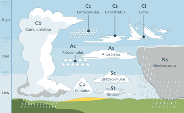
The individual genus types result from the physical forms being cross-classified by altitude level or étage within the troposphere. The base-height range for each étage varies depending on the latitudinalgeographical zone.[20] A consensus exists as to the designation of high, middle, and low étages, the makeup of the basic canon of ten cloud genera that results from this cross-classification, and the étage designations of non-vertical genus types. Clouds with significant vertical extent occupy more than one étage and are commonly, but not always, treated as a separate group or sub-group, or given separate descriptions within the context of the standard étages.[21][22][23] The physical forms and their constituent genera are given in approximate ascending order of instability or convective activity.[24]
Stratiform[edit]
The stratiform group is cross-classified into the genera cirrostratus (high-étage), altostratus (middle-étage), stratus (low-étage), and nimbostratus (multi-étage). Non-convective stratiform clouds appear instable airmass conditions and, in general, have flat sheet-like structures that can form at any altitude in the troposphere.[25] Very low stratiform cloud results when advection fog is lifted above surface level during breezy conditions.
Cirriform[edit]
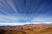
Cirriform clouds are generally of the genus cirrus and have the appearance of detached or semi-merged filaments. They form at high tropospheric altitudes in air that is mostly stable with little or no convective actity, although denser patches may occasionally show buildups caused by limited high-level convection where the air is partly unstable.[26]
Stratocumuliform[edit]
The stratocumuliform group is cross-classified into the genera cirrocumulus (high-étage), altocumulus (middle-étage), and stratocumulus (low-étage). Clouds of this structure have both cumuliform and stratiform characteristics in the form of rolls or ripples. They generally form as a result of limited convection in an otherwise mostly stable airmass topped by an inversion layer.[12] Layered altocumulus and cirrocumulus are physically more closely related to stratocumulus than to cumulus heaps. However, some semantic ambiguity regarding the physical relationships between these cumuliform and stratocumuliform clouds can arise because, in the case of the latter form, the strato- prefix is dropped from the names of the alto- and cirro- genus types to avoid double prefixing. Cirro-stratocumulus is therefore abbreviated to cirrocumulus and alto-stratocumulus is shortened to altocumulus.
Cumuliform[edit]
Clouds of this form may be low or multi-étage depending on their vertical size and extent. They are typically of the genus cumulus which appear in isolated heaps.[27][28] They are the product of localized but generally free-convective lift where there are no inversion layers in the atmosphere to limit vertical growth. In general, small cumuliform clouds tend to indicate comparatively weak instability. Larger cumulus types are a sign of moderate to strong atmospheric instability and convective activity.[29]
Cumulonimbiform[edit]
See also: Atmospheric convection
The largest free-convective clouds comprise the genus cumulonimbus which are multi-étage because of their great vertical extent. They occur in highly unstable air[30] and often have complex structures that include cirriform tops and multiple accessory clouds.
Summary of étages and genera[edit]
See also: Weather map and Station model
The forms and resultant genus types can be grouped by étage. This is generally done for the purpose of cloud atlases, surface weather observations[21] and weather maps.[31] These maps are produced from information in the international synoptic code (or SYNOP) that are transmitted at regular intervals by professionally trained staff at major weather stations.
Non-vertical or single-étage genera are listed and summarised below in approximate descending order of the altitude at which each normally occurs.[32] Multi-étage clouds with significant vertical extent are separately listed and summarised in approximate ascending order of instability or convective activity.[24]
High cirriform, stratocumuliform, and stratiform genera[edit]
Clouds of the high étage form at altitudes of 3,000 to 7,600 m (10,000 to 25,000 ft) in the polar regions, 5,000 to 12,200 m (16,500 to 40,000 ft) in the temperate regions and 6,100 to 18,300 m (20,000 to 60,000 ft) in the tropical region.[20] All cirriform clouds are classified as high and thus constitute a single genus cirrus (Ci). Stratocumuliform and stratiform clouds in the high étage carry the prefix cirro-, yielding the respective genus names cirrocumulus (Cc) and cirrostratus (Cs). When satellite images of high clouds are analized without supporting data from direct human observations, it becomes impossible to distinguish between individual genus types which are then collectively identified as cirrus-type.[33]
- Genus cirrus (Ci):
- These are mostly fibrous wisps of delicate white cirriform ice crystal cloud that show up clearly against the blue sky.[26] Cirrus are generally non-convective except castellanus and floccus subtypes which show limited convection. They often form along a high altitude jetstream[34] and at the very leading edge of a frontal or low-pressure disturbance where they may merge into cirrostratus.[35] These high clouds do not produce precipitation.[32]
- Genus cirrocumulus (Cc):
- This is a pure white high-étage stratocumuliform layer of limited convection. It is composed of ice crystals or supercooled water droplets appearing as small unshaded round masses or flakes in groups or lines with ripples like sand on a beach.[36][37] Cirrocumulus occasionally forms alongside cirrus and may be accompanied or replaced by cirrostratus clouds at the very leading edge of an active weather system.[35]
- Genus cirrostratus (Cs):
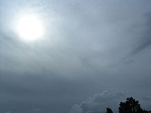
- Cirrostratus is a thin non-convective stratiform ice crystal veil that typically gives rise to halos caused by refraction of the sun's rays. The sun and moon are visible in clear outline.[35] Cirrostratus often thickens into altostratus ahead of a warm front or low-pressure area.[38]
Middle stratocumuliform and stratiform genera[edit]
Non-vertical clouds in the middle étage are prefixed by alto-, yielding the genus names altocumulus (Ac) and altostratus (As). These clouds can form as low as 2,000 m (6,500 ft) above surface at any latitude, but may be based as high as 4,000 m (13,000 ft) near the poles, 7,000 m (23,000 ft) at mid latitudes, and 7,600 m (25,000 ft) in the tropics.[20] As with high clouds, it is not always possible to distinguish between individual genera using satellite photography alone. Without the addition of human observations, these clouds are usually collectively identified as 'middle-type' on satellite images.[33]
- Genus altocumulus (Ac):
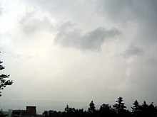
- This is a middle-étage stratocumuliform cloud layer of limited convection that is usually appears in the form of irregular patches or more extensive sheets arranges in groups, lines, or waves.[39] High altocumulus may resemble cirrocumulus but is usually thicker and composed of water droplets so that the bases show at least some light-grey shading. Opaque altocumulus associated with a weak frontal or low-pressure disturbance can produce virga, very light intermittent precipitation that evaporates before reaching the ground. If the altocumulus is mixed with moisture-laden altostratus, the precipitation may reach the ground.
- Genus altostratus (As):
- Altostratus is a mid-level opaque or translucent stratiform or non-convective veil of grey/blue-grey cloud that often forms along warm fronts and around low-pressure areas. Altostratus is usually composed of water droplets but may be mixed with ice crystals at higher altitudes. Widespread opaque altostratus can produce light continuous or intermittent precipitation.[38] Precipitation commonly becomes heavier and more widespread if it thickens into nimbostratus.[40]
Low stratocumuliform, stratiform, and cumuliform genera[edit]
Low-étage clouds are found from near surface up to 2,000 m (6,500 ft).[20] Genus types in this étage either have no prefix or carry one that refers to a characteristic other than altitude.
- Genus stratocumulus (Sc):
- This genus type is a stratocumuliform cloud layer of limited convection, usually in the form of irregular patches or more extensive sheets similar to altocumulus but having larger elements with deeper-gray shading.[41]Opaque stratocumulus can produce very light intermittent precipitation. This cloud often forms under a precipitating deck of altostratus or high-based nimbostratus associated with a well-developed warm front, slow-moving cold front, or low-pressure area. This can create the illusion of continuous precipitation of more than very light intensity falling from stratocumulus.
- Genus stratus (St):
- This is a flat or sometimes ragged non-convective stratiform type that sometimes resembles elevated fog.[42] Only very weak precipitation can fall from this cloud (usually drizzle or snow grains), although heavier rain or snow may fall through a stratus layer from a higher precipitating cloud deck. When a low stratiform cloud contacts the ground, it is called fog if the prevailing surface visibility is less than 1 kilometer, although radiation and advection types of fog tend to form in clear air rather than from stratus layers. If the visibility increases to 1 kilometer or higher in any kind of fog, the visible condensation is termed mist.
- Genus cumulus (Cu) – little vertical extent:
- These are small detached fair-weather cumuliform clouds that have nearly horizontal bases and flattened tops, and do not produce rain showers.[43]
Multi-étage stratiform, cumuliform, and cumulonimbiform genera (low to middle cloud base)[edit]
These clouds have low to middle-étage bases that form anywhere from near surface to about 2,400 m (8,000 ft). Some classifications limit the term vertical to upward-growing free-convective cumuliform and cumulonimbiform genera.[44][45] Downward-growing nimbostratus can be as thick as most upward-growing vertical cumulus, but its horizontal extent tends to be even greater. This sometimes leads to the exclusion of this genus type from the group of vertical clouds. Classifications that follow this approach usually show nimbostratus either as low-étage[44][46] to denote its normal base height range, or as middle,[20] based on the altitude range at which it normally forms. Sometimes the terms multi-level or multi-étage are used for all very thick or tall cloud types including nimbostratus to avoid the association of 'vertical' with free-convective cumuliform only.[23] Alternatively, some classifications do not recognize a vertical or multi-étage designation and include all vertical free-convective cumuliform and cumulonimbiform types with the low-étage clouds.[20]
Nimbostratus and some cumulus in this group usually achieve moderate or deep vertical extent, but without towering structure. However, with sufficient airmass instability, upward-growing cumuliform clouds can grow to high towering proportions. Although genus types with vertical extent are often considered a single group,[22] the International Civil Aviation Organization (ICAO) further distinguishes towering vertical clouds as a separate group or sub-group by specifying that these very large cumuliform and cumulonimbiform types must be identified by their standard names or abbreviations in all aviation observations (METARS) and forecasts (TAFS) to warn pilots of possible severe weather and turbulence.[47] When towering vertical types are considered separately, they comprise the aforementioned cumulonimbus genus and one cumulus subtype or species, cumulus congestus (Cu con). This subtype is designated towering cumulus (Tcu) by ICAO. There is no stratiform type in this group because by definition, even very thick stratiform clouds cannot have towering vertical structure, although they may be accompanied by embedded towering cumuliform or cumulonimbiform types.[23][48]
- Moderate and deep vertical
- Genus nimbostratus (Ns):
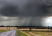
- This is a diffuse dark-grey non-convective stratiform layer with great horizontal extent and moderate to deep vertical development. It lacks towering structure and looks feebly illuminated from the inside.[40] Ns normally forms from middle-étage altostratus, and develops at least moderate vertical extent[22][23] when the base subsides into the low étage during precipitation that can reach moderate to heavy intensity. It commonly achieves deep vertical development when it simultaneously grows upward into the high étage due to large scale frontal or cyclonic lift.[49] The nimbo- prefix refers to its ability to produce continuous rain or snow over a wide area, especially ahead of a warm front.[50]
- Genus cumulus (Cu) – moderate vertical extent:
- These cumuliform clouds of free convection have clear-cut medium-grey flat bases and white domed tops in the form of small sproutings and generally do not produce precipitation.[43] They usually form in the low étage except during conditions of very low relative humidity when the clouds bases can rise into the middle altitude range.
- Towering vertical
See also: Atmospheric convection
These clouds are sometimes classified separately from the other vertical or multi-étage types because of their ability to produce severe turbulence.[47]
- Genus cumulus (Cu) – great vertical extent:
- Increasing airmass instability can cause free-convective cumulus to grow very tall to the extent that the vertical height from base to top is greater than the base-width of the cloud. The cloud base takes on a darker grey coloration and the top commonly resembles a cauliflower. This cloud type can produce moderate to heavy showers.[43]
- Genus cumulonimbus (Cb):
For information about the life-cycle or stages of a cumulonimbus, see Cumulonimbus cloud.
- This genus type is a heavy towering cumulonimbiform mass of free convective cloud with a dark-grey to nearly black base and a very high top in the form of a mountain or huge tower.[51] Cumulonimbus can producethunderstorms, local very heavy downpours of rain that may cause flash floods, and a variety of types of lightning including cloud-to-ground that can cause wildfires.[52] Other convective severe weather may or may not be associated with thunderstorms and include heavy snow showers, hail,[53] strong wind shear, downbursts,[54] and tornadoes.[55] Of all these possible cumulonimbus-related events, lightning is the only one of these that requires a thunderstorm to be taking place since it is the lightning that creates the thunder. Cumulonimbus clouds can form in unstable airmass conditions, but tend to be more concentrated and intense when they are associated with unstable cold fronts.[56]
Species[edit]
For a comprehensive listing of usual combinations of genera and sub-types, see List of cloud types.
Genus types are commonly divided into subtypes called species that indicate specific structural details which can vary according to the stability and windshear characteristics of the atmosphere at any given time and location. Despite this hierarchy, a particular species may be a subtype of more than one genus, especially if the genera are of the same physical form and are differentiated from each other mainly by altitude or étage. Some species can even be subtypes of genera belonging to more than one physical form.[57]
The species types are grouped according to the physical forms and genera with which each is normally associated. The forms, genera, and species are listed in approximate ascending order of instability or convective activity.[24]
Stable stratiform species[edit]
Of the stratiform group, high-level cirrostratus comprises two species. Cirrostratus nebulosus has a rather diffuse appearance lacking in structural detail. Cirrostratus fibratus is a species made of semi-merged filaments that are transitional to or from cirrus. Altostratus and multi-level nimbostratus always have a flat or diffuse appearance and are therefore not subdivided into species. Low-étage stratus is of the species nebulosus except when broken up into ragged sheets of stratus fractus (see below).[22][57][58]
Mostly stable cirriform species[edit]
Cirriform clouds have three non-convective species that can form in mostly stable airmass conditions. Cirrus fibratus comprise filaments that may be straight, wavy, or occasionally twisted by non-convective wind shear. The species uncinus is similar but has upturned hooks at the ends. Cirrus spissatus appear as opaque patches that can show light grey shading.[57]
Mostly stable stratocumuliform species[edit]
Stratocumuliform genus-types (cirrocumulus, altocumulus, and stratocumulus) that appear in mostly stable air have two species each that can form in the high, middle, or low étages of the troposphere. The stratiformis species normally occur in extensive sheets or in smaller patches where there is only minimal convective activity. Clouds of the lenticularis species tend to have lens-like shapes tapered at the ends. They are most commonly seen as orographic mountain-wave clouds, but can occur anywhere in the troposphere where there is strong wind shear combined with sufficient airmass stability to maintain a generally flat cloud structure.[22][57][58]
Ragged stratiform/cumuliform species[edit]
The species fractus shows variable instability because it can be a subdivision of genus-types of different physical forms that have different stability characteristics. This subtype can be in the form of ragged but mostly stablestratiform sheets (stratus fractus) or small ragged cumuliform heaps with somewhat greater unstability (cumulus fractus).[57][58] Because of their relatively low altitudes, stratiform and cumuliform genus-types can be torn up into shreds by brisk low level winds that create mechanical turbulance against the ground. Fractus clouds can form in precipitation at low altitudes, with or without brisk or gusty winds. They are closely associated with precipitating cloud systems of considerable vertical and sometimes horizontal extent, so they are also classified as accessory clouds under the name pannus (see section on supplementary features).
Unstable cirriform/stratocumuliform species[edit]
These are species that can also be subdivisions of genera of two physical different forms; these being cirriform and stratocumuliform when they form in unstable air. With increasing airmass instability, the species castellanus, which resemble the turrets of a castle when viewed from the side, can be found with stratocumuliform genera at any altitude level and with limited-convective patches of high-étage. cirrus. Clouds of the more detached tuftedfloccus species are also subdivisions of genus-types which may be cirriform or stratocumuliform. They are sometimes seen with cirrus, cirrocumulus, and altocumulus, but not stratocumulus.[57][58]
Unstable cumuliform species[edit]
More general airmass instability in the troposphere tends to produce clouds of the more freely convective cumulus genus type, whose species are mainly indicators of degrees of atmospheric instability and resultant vertical development of the clouds. A cumulus cloud initially forms as a cloudlet of the species humilis that shows only slight vertical development. If the air becomes more unstable, the cloud tends to grow vertically into the speciesmediocris, then congestus, the tallest cumulus species.[57]
Unstable cumulonimbiform species[edit]
With highly unstable atmospheric conditions, large cumulus may continue to grow into cumulonimbus calvus (essentially a very tall congestus cloud that produces thunder), then ultimately into the species capillatus when supercooled water droplets at the top turn into ice crystals giving it a cirriform appearance.[57][58]
Varieties[edit]
Genus and species types are further subdivided into varieties whose names can appear after the species name to provide a fuller description of a cloud. Some cloud varieties are not restricted to a specific étage or form, and can therefore be common to more than one genus or species.[59]
Opacity-based[edit]
All cloud varieties fall into one of two main groups. One group identifies the opacities of particular low and middle étage cloud structures and comprises the varieties translucidus (thin translucent), perlucidus (thick opaque with translucent breaks), and opacus (thick opaque). These varieties are always identifiable for cloud genera and species with variable opacity. All three are associated with the stratiformis species of altocumulus and stratocumulus. However, only two varieties are seen with altostratus and stratus nebulosus whose uniform structures prevent the formation of a perlucidus variety. Opacity-based varieties are not applied to high-étage clouds because they are always translucent, or in the case of cirrus spissatus, always opaque.[59][60] Similarly, these varieties are also not associated with moderate and towering vertical clouds because they are always opaque.
Pattern-based[edit]
A second group describes the occasional arrangements of cloud structures into particular patterns that are discernible by a surface-based observer (cloud fields usually being visible only from a significant altitude above the formations). These varieties are not always present with the genera and species with which they are otherwise associated, but only appear when atmospheric conditions favor their formation. Intortus and vertebratus varieties occur on occasion with cirrus fibratus. They are respectively filaments twisted into irregular shapes, and those that are arranged in fishbone patterns, usually by uneven wind currents that favor the formation of these varieties. The variety radiatus is associated with cloud rows of a particular type that appear to converge at the horizon. It is sometimes seen with the fibratus and uncinus species of cirrus, the stratiformis species of altocumulus and stratocumulus, the mediocris and sometimes humilis species of cumulus,[62][63] and with the genus altostratus.
Another variety, duplicatus (closely spaced layers of the same type, one above the other), is sometimes found with cirrus of both the fibratus and uncinus species, and with altocumulus and stratocumulus of the species stratiformis and lenticularis. The variety undulatus (having a wavy undulating base) can occur with any clouds of the species stratiformis or lenticularis, and with altostratus. It is only rarely observed with stratus nebulosus. The variety lacunosus is caused by localized downdrafts that create circular holes in the form of a honeycomb or net. It is occasionally seen with cirrocumulus and altocumulus of the species stratiformis, castellanus, and floccus, and with stratocumulus of the species stratiformis and castellanus.[59][60]
Combinations[edit]
It is possible for some species to show combined varieties at one time, especially if one variety is opacity-based and the other is pattern-based. An example of this would be a layer of altocumulus stratiformis arranged in seemingly converging rows separated by small breaks. The full technical name of a cloud in this configuration would be altocumulus stratiformis radiatus perlucidus, which would identify respectively its genus, species, and two combined varieties.[58][59][60]
Accessory clouds, supplementary features, and other derivative formations[edit]
Supplementary features and accessory clouds are not further subdivisions of cloud types below the species and variety level. Rather, they are either hydrometeors or special cloud formations with their own Latin names that form in association with certain cloud genera, species, and varieties.[58][60] Supplementary features, whether in the form of clouds or precipitation, are directly attached to the main genus-cloud. Accessory clouds, by contrast, are generally detached from the main cloud.[64]
Precipitation-based supplementary features[edit]
One group of supplementary features are not actual cloud formations, but precipitation that falls when water droplets or ice crystals that make up visible clouds have grown too heavy to remain aloft. Virga is a feature seen with clouds producing precipitation that evaporates before reaching the ground, these being of the genera cirrocumulus, altocumulus, altostratus, nimbostratus, stratocumulus, cumulus, and cumulonimbus.[64]
When the precipitation reaches the ground without completely evaporating, it is designated as the feature praecipitatio.[65] This normally occurs with altostratus opacus, which can produce widespread but usually light precipitation, and with thicker clouds that show significant vertical development. Of the latter, upward-growing cumulus mediocris produces only isolated light showers, while downward growing nimbostratus is capable of heavier, more extensive precipitation. Towering vertical clouds have the greatest ability to produce intense precipitation events, but these tend to be localized unless organized along fast-moving cold fronts. Showers of moderate to heavy intensity can fall from cumulus congestus clouds. Cumulonimbus, the largest of all cloud genera, has the capacity to produce very heavy showers. Low stratus clouds usually produce only light precipitation, but this always occurs as the feature praecipitatio due to the fact this cloud genus lies too close to the ground to allow for the formation of virga.[58][60][64]
Cloud-based supplementary features[edit]
Incus is the most type-specific supplementary feature, seen only with cumulonimbus of the species capillatus. A cumulonimbus incus cloud top is one that has spread out into a clear anvil shape as a result of rising air currents hitting the stability layer at the tropopause where the air no longer continues to get colder with increasing altitude.[66]
The mamma feature forms on the bases of clouds as downward-facing bubble-like protuberances caused by localized downdrafts within the cloud. It is also sometimes called mammatus, an earlier version of the term used before a standardization of Latin nomenclature brought about by the World Meterorological Organization during the 20th century. The best-known is cumulonimbus with mammatus, but the mamma feature is also seen occasionally with cirrus, cirrocumulus, altocumulus, altostratus, and stratocumulus.[64]
A tuba feature is a cloud column that may hang from the bottom of a cumulus or cumulonimbus. A newly formed or poorly organized column might be comparatively benign, but can quickly intensify into a funnel cloud or tornado.[64][67][68]
An arcus feature is a roll cloud with ragged edges attached to the lower front part of cumulus congestus or cumulonimbus that forms along the leading edge of a squall line or thunderstorm outflow.[69] A large arcus formation can have the appearance of a dark menacing arch.[64]
There are some arcus-like clouds that form as a consequence of interactions with specific geographical features rather than with a parent cloud. Perhaps the strangest geographically specific cloud of this type is the Morning Glory, a rolling cylindrical cloud that appears unpredictably over the Gulf of Carpentaria in Northern Australia. Associated with a powerful "ripple" in the atmosphere, the cloud may be "surfed" in glider aircraft. It has been officially suggested that roll clouds of this type that are not attached to a parent cloud be reclassified as a new species of stratocumulus, possibly with the Latin name volutus.[70]
Accessory clouds[edit]
Supplementary cloud formations detached from the main cloud are known as accessory clouds.[58][60][64] The heavier precipitating clouds, nimbostratus, towering cumulus (cumulus congestus), and cumulonimbus typically see the formation in precipitation of thepannus feature, low ragged clouds of the genera and species cumulus fractus or stratus fractus.
After the pannus types, the remaining accessory clouds comprise formations that are associated mainly with upward-growing cumuliform and cumulonimbiform clouds of free convection. Pileus is a cap cloud that can form over a cumulonimbus or large cumulus cloud,[71] whereas a velum feature is a thin horizontal sheet that sometimes forms like an apron around the middle or in front of the parent cloud.[64]
Under conditions of strong atmospheric wind shear and instability, wave-like undulatus formations may break into regularly spaced crests. This variant has no separate WMO Latin designation, but is sometimes known informally as a Kelvin-Helmholtz wave cloud. This phenomenon has also been observed in cloud formations over other planets and even in the sun's atmosphere.[72] It has been formally suggested that this wave cloud be classified as a supplementary feature, possibly with the Latin name fluctus. Another wave-like cloud feature that is distinct from the variety undulatus has been given the Latin name asperatus. It has been recommended for formal classification as a supplementary feature using its suggested Latin name.[70]
A circular fall-streak hole occasionally forms in a thin layer of supercooled altocumulus or cirrocumulus. Fall streaks consisting of virga or wisps of cirrus are usually seen beneath the hole as ice crystals fall out to a lower altitude. This type of hole is usually larger than typical lacunosus holes, and a formal recommendation has been made to classify it as a supplementary feature, possibly with the Latin name cavus.[70]
Mother clouds[edit]
Clouds initially form in clear air or become clouds when fog rises above surface level. The genus of a newly formed cloud is determined mainly by air mass characteristics such as stability and moisture content. If these characteristics change over time, the genus tends to change accordingly. When this happens, the original genus is called a mother cloud. If the mother cloud retains much of its original form after the appearance of the new genus, it is termed a genitus cloud. One example of this is stratocumulus cumulogenitus, a stratocumulus cloud formed by the partial spreading of a cumulus type when there is a loss of convective lift. If the mother cloud undergoes a complete change in genus, it is considered to be a mutatus cloud.[32]
It has been officially recommended that the genitus category be expanded to include certain types that do not originate from pre-existing clouds or as the result of any natural atmospheric processes. Among vertically developed clouds, these may include flammagenitus for cumulus congestus or cumulonimbus that are formed by large scale fires or volcanic eruptions. Smaller low-étage "pyrocumulus" or "fumulus" clouds formed by contained industrial activity could be classified as cumulus homogenitus. Contrails formed from the exhaust of aircraft flying in the high étage can persist and spread into formations resembling any of the high cloud genus-types. These variants have no special WMO designations, but are sometimes given the faux-Latin name Aviaticus. Persistent contrails have been identified as candidates for possible inclusion in the genitus category as cirrus, cirrostratus, or cirrocumulus homogenitus[70]
Stratocumulus fields[edit]
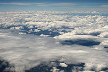
Stratocumulus clouds can be organized into "fields" that take on certain specially classified shapes and characteristics. In general, these fields are more discernible from high altitudes than from ground level. They can often be found in the following forms:
- Actinoform, which resembles a leaf or a spoked wheel.
- Closed cell, which is cloudy in the center and clear on the edges, similar to a filled honeycomb.[73]
- Open cell, which resembles an empty honeycomb, with clouds around the edges and clear, open space in the middle.[74]
Vortex streets[edit]
Main article: Karman vortex street
These patterns are formed from a phenomenon known as a Kármán vortex which is named after the engineer and fluid dynamicist Theodore von Kármán,.[75] When wind driven clouds are forced through a mountain range, or when ocean wind driven clouds encounter a high elevation island, they can begin to circle the mountain or high land mass. They can form at any altitude in the troposphere and are not restricted to any particular cloud type.
Formation and distribution[edit]
How the air becomes saturated[edit]
Main article: Cloud physics
Air can become saturated as a result of being cooled to its dew point or by having moisture added from an adjacent source. Adiabatic cooling occurs when one or more of three possible lifting agents - cyclonic/frontal, convective, or orographic — causes air containing invisible water vapor to rise and cool to its dew point, the temperature at which the air becomes saturated. The main mechanism behind this process is adiabatic cooling.[76] If the air is cooled to its dew point and becomes saturated, it normally sheds vapor it can no longer retain, which condenses into cloud. Water vapor in saturated air is normally attracted tocondensation nuclei such as dust and salt particles that are small enough to be held aloft by normal circulation of the air.[30][77]
Frontal and cyclonic lift occur when stable air is forced aloft at weather fronts and around centers of low pressure.[78] Warm fronts associated with extratropical cyclones tend to generate mostly cirriform and stratiform clouds over a wide area unless the approaching warm airmass is unstable, in which case cumulus congestus or cumulonimbus clouds will usually be embedded in the main precipitating cloud layer.[79]Cold fronts are usually faster moving and generate a narrower line of clouds which are mostly stratocumuliform, cumuliform, or cumulonimbiform depending on the stability of the warm air mass just ahead of the front.[56]
Another agent is the convective upward motion of air caused by daytime solar heating at surface level.[30] Airmass instability allows for the formation of cumuliform clouds that can produce showers if the air is sufficiently moist.[80] On comparatively rare occasions, convective lift can be powerful enough to penetrate the tropopause and push the cloud top into the stratosphere.[81]
A third source of lift is wind circulation forcing air over a physical barrier such as a mountain (orographic lift).[30] If the air is generally stable, nothing more than lenticular cap clouds will form. However, if the air becomes sufficiently moist and unstable, orographic showers or thunderstorms may appear.[82]
Along with adiabatic cooling that requires a lifting agent, there are three major non-adiabatic mechanisms for lowering the temperature of the air to its dew point. Conductive, radiational, and evaporative cooling require no lifting mechanism and can cause condensation at surface level resulting in the formation of fog.[83][84][85]
There are several main sources of water vapor that can be added to the air as a way of achieving saturation without any cooling process: Water or moist ground,[86][87][88] precipitation or virga,[89] and transpiration from plants[90]
Convergence along low-pressure zones[edit]
Main articles: Intertropical convergence zone, Extratropical cyclone, Cold front and Warm front
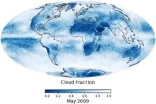
Although the local distribution of clouds can be significantly influenced by topography, the global prevalence of cloud cover tends to vary more by latitude. It is most prevalent globally in and along low pressure zones of surface atmospheric convergence which encircle the Earth close to the equator and near the 50th parallels of latitude in the northern and southern hemispheres.[91] The adiabatic cooling processes that lead to the creation of clouds by way of lifting agents are all associated with convergence; a process that involves the horizontal inflow and accumulation of air at a given location, as well as the rate at which this happens.[92] Near the equator, increased cloudiness is due to the presence of the low-pressure Intertropical Convergence Zone (ITCZ) where very warm and unstable air promotes mostly cumuliform and cumulonimbiform clouds.[93] Clouds of virtually any type can form along the mid-latitude convergence zones depending on the stability and moisture content of the air. These extratropical convergence zones are occupied by the polar fronts where air masses of polar origin meet and clash with those of tropical or subtropical origin.[94] This leads to the formation of weather-making extratropical cyclones composed of cloud systems that may be stable or unstable to varying degrees according to the stability characteristics of the various airmasses that are in conflict.[95]
Divergence along high pressure zones[edit]
Main articles: Subtropical ridge and Polar high
Divergence is the opposite of convergence. In the Earth's atmosphere, it involves the horizontal outflow of air from the upper part of a rising column of air, or from the lower part of a subsiding column often associated with an area or ridge of high pressure.[92] Cloudiness tends to be least prevalent near the poles and in the subtropics close to the 20th parallels, north and south. The latter are sometimes referred to as the horse latitudes. The presence of a large-scale high-pressure subtropical ridge on each side of the equator reduces cloudiness at these low latitudes. Similar patterns also occur at higher latitudes in both hemispheres.
Polar stratospheric clouds[edit]
Main article: Polar stratospheric clouds
Polar stratospheric clouds show little variation in structure and are limited to a single very high range of altitude of about 15,000–25,000 m (49,200–82,000 ft), so they are not classified into étages, genus types, species, or varieties in the manner of tropospheric clouds. Instead, the classification is alpha-numeric and is based on chemical makeup rather than variations in physical appearance.[96]
Types and subtypes[edit]
Nacreous and non-nacreous (very high cirriform)[edit]
- Type 1 (Non-nacreous): This type contains frozen or supercooled nitric acid and water droplets and lacks any special coloration. It is dividable into subtype 1A which is mostly made up of water ice crystals and frozen nitric acid, 1B which consists of supercooled droplets of nitric and sulfuric acid, and subtype 1C which comprises small particles of nitric acid. Nacreous type 2 is sometimes associated or embedded.[96]
- Type 2 (Nacreous): Nacreous polar stratospheric cloud consists of ice crystals only and generally shows mother-of-pearl colors.[96]
Formation and distribution[edit]
Polar stratospheric clouds form in the lowest part of the stratosphere during the winter, at the altitude and during the season that produces the coldest temperatures and therefore the best chances of triggering condensation caused by adiabatic cooling. They are typically very thin with an undulating cirriform appearance.[97] Moisture is scarce in the stratosphere, so nacreous and non-nacreous cloud at this altitude range is rare and is usually restricted to polar regions in the winter where the air is coldest.
Polar mesospheric clouds[edit]
Main article: Polar mesospheric clouds
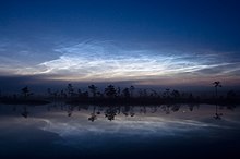
Polar mesospheric clouds form at a single extreme altitude range of about 80 to 85 km (50 to 53 mi) and are consequently not classified into more than one étage. They are given the Latin name noctilucent because of their illumination well after sunset and before sunrise. An alpha-numeric classification is used to identify variations in physical appearance.[14]
Types and subtypes[edit]
Noctilucent (extremely high cirriform)[edit]
- Type 1: The first type is characterized by very tenuous filaments resembling cirrus fibratus.[14]
- Type 2: This type comprises bands in the form of long streaks, often in groups or interwoven at small angles, similar to cirrus intortus. It is dividable into two subtypes; 2A where the streaks have diffuse, blurred edges, and 2B where they have sharply defined edges.[14]
- Type 3: Billows in the form of short streaks can be seen that are clearly spaced and roughly parallel. Subtype 3A has short, straight, narrow streaks while 3B has wave-like streaks similar to cirrus undulatus.[14]
- Type 4: This shows whirls in the form of partial or rarely complete rings with dark centers. With subtype 4A, the whirls are of small angular radius and have a similar appearance to surface water ripples. 4B is characterized by simple curves of medium angular radius with one or more bands. Subtype 4C has whirls with large-scale ring structure.[14]
Formation and distribution[edit]
Polar mesospheric clouds are the highest in the atmosphere and form near the top of the mesosphere at about ten times the altitude of tropospheric high clouds.[98] From ground level, they can occasionally be seen illuminated by the sun during deep twilight. Ongoing research indicates that convective lift in the mesosphere is strong enough during the polar summer to cause adiabatic cooling of small amount of water vapour to the point of saturation. This tends to produce the coldest temperatures in the entire atmosphere just below the mesopause. These conditions result in the best environment for the formation of polar mesospheric clouds.[99] There is also evidence that smoke particles from burnt-up meteors provide much of the condensation nuclei required for the formation of noctilucent cloud.[100]
Distribution in the mesosphere is similar to the stratosphere except at much higher altitudes. Because of the need for maximum cooling of the water vapor to produce noctilucent clouds, their distribution tends to be restricted to polar regions of Earth. A major seasonal difference is that convective lift from below the mesosphere pushes very scarce water vapor to higher colder altitudes required for cloud formation during the respective summer seasons in the northern and southern hemispheres. Sightings are rare more than 45 degrees south of the north pole or north of the south pole.[14]
Clouds throughout the homosphere[edit]
Luminance and reflectivity[edit]
The luminance or brightness of a cloud in the homosphere (which includes the troposphere, stratosphere, and mesosphere) is determined by how light is reflected, scattered, and transmitted by the cloud's particles. Its brightness may also be affected by the presence of haze or photometeors such as halos and rainbows.[101] In the troposphere, dense, deep clouds exhibit a high reflectance (70% to 95%) throughout the visible spectrum. Tiny particles of water are densely packed and sunlight cannot penetrate far into the cloud before it is reflected out, giving a cloud its characteristic white color, especially when viewed from the top.[102] Cloud droplets tend to scatter light efficiently, so that the intensity of the solar radiation decreases with depth into the gases. As a result, the cloud base can vary from a very light to very-dark-grey depending on the cloud's thickness and how much light is being reflected or transmitted back to the observer. High thin tropospheric clouds reflect less light because of the comparatively low concentration of constituent ice crystals or supercooled water droplets which results in a slightly off-white appearance. However, a thick dense ice-crystal cloud appears brilliant white with pronounced grey shading because of its greater reflectivity.[101]
As a tropospheric cloud matures, the dense water droplets may combine to produce larger droplets. If the droplets become too large and heavy to be kept aloft by the air circulation, they will fall from the cloud as rain. By this process of accumulation, the space between droplets becomes increasingly larger, permitting light to penetrate farther into the cloud. If the cloud is sufficiently large and the droplets within are spaced far enough apart, a percentage of the light that enters the cloud is not reflected back out but is absorbed giving the cloud a darker look. A simple example of this is one's being able to see farther in heavy rain than in heavy fog. This process of reflection/absorption is what causes the range of cloud color from white to black.[103]
Coloration[edit]
Striking cloud colorations can be seen at many altitudes in the homosphere. The color of a cloud is usually the same as the incident light.[104]
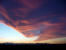
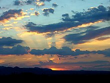
During daytime when the sun is relatively high in the sky, tropospheric clouds generally appear bright white on top with varying shades of grey underneath. Thin clouds may look white or appear to have acquired the color of their environment or background. Red, orange, and pink clouds occur almost entirely at sunrise/sunset and are the result of the scattering of sunlight by the atmosphere. When the sun is just below the horizon, low-etage clouds are gray, middle clouds appear rose-colored, and high-etage clouds are white or off-white. Clouds at night are black or dark grey in a moonless sky, or whitish when illuminated by the moon. They may also reflect the colors of large fires, city lights, or auroras that might be present.[104]
A cumulonimbus cloud that appears to have a greenish/bluish tint is a sign that it contains extremely high amounts of water; hail or rain which scatter light in a way that gives the cloud a blue color. A green colorization occurs mostly late in the day when the sun is comparatively low in the sky and the incident sunlight has a reddish tinge that appears green when illuminating a very tall bluish cloud. Supercell type storms are more likely to be characterized by this but any storm can appear this way. Coloration such as this does not directly indicate that it is a severe thunderstorm, it only confirms its potential. Since a green/blue tint signifies copious amounts of water, a strong updraft to support it, high winds from the storm raining out, and wet hail; all elements that improve the chance for it to become severe, can all be inferred from this. In addition, the stronger the updraft is, the more likely the storm is to undergo tornadogenesis and to produce large hail and high winds.[105]
Yellowish clouds may be seen in the troposphere in the late spring through early fall months during forest fire season. The yellow color is due to the presence of pollutants in the smoke. Yellowish clouds caused by the presence of nitrogen dioxide are sometimes seen in urban areas with high air pollution levels.[106]
In high latitude regions of the stratosphere, nacreous clouds occasionally found there during the polar winter tend to display quite striking displays of mother-of-pearl colorations.[96] This is due to the refraction and diffusion of the sun's rays through thin clouds with supercooled droplets that often contain compounds other than water. At still higher altitudes up in the mesosphere, noctilucent clouds made of ice crystals are sometimes seen in polar regions in the summer. They typically have a bluish or silvery white coloration that can resemble brightly illuminated cirrus. Noctilucent clouds may occasionally take on more of a red or orange hue.[14]
Effects on climate and the atmosphere[edit]
See also: Cloud cover, Cloud feedback, Global warming and Climate change
The role of tropospheric clouds in regulating weather and climate remains a leading source of uncertainty in projections of global warming.[109][110] This uncertainty arises because of the delicate balance of processes related to clouds, spanning scales from millimeters to planetary. Hence, interactions between the large-scale (synoptic meteorology) and clouds becomes difficult to represent in global models.
The complexity and diversity of clouds, as outlined above, adds to the problem. On the one hand, white-colored cloud tops promote cooling of Earth's surface by reflecting short-wave radiation from the sun. Most of the sunlight that reaches the ground is absorbed, warming the surface, which emits radiation upward at longer, infrared, wavelengths. At these wavelengths, however, water in the clouds acts as an efficient absorber. The water reacts by radiating, also in the infrared, both upward and downward, and the downward long-wave radiation results in some warming at the surface. This is analogous to the greenhouse effect of greenhouse gases and water vapor.[111]
High-étage tropospheric genus-types, cirrus, cirrocumulus, and cirrostratus, particularly show this duality with both short-wave albedo cooling and long-wave greenhouse warming effects. On the whole though, ice-crystal clouds in the upper troposphere tend to favor net warming.[112][113] However, the cooling effect is dominant with lower clouds made of very small water droplets, especially when they form in extensive sheets that block out more of the sun. These include middle-étage layers of altocumulus and altostratus as well as low stratocumulus, and stratus that have droplets with an average radius of about 0.002 mm (0.00008 in).,.[77] Small-droplet aerosols are not good at absorbing long-wave radiation reflected back from Earth, so there is a net cooling with almost no long-wave effect. This effect is particularly pronounced with low-étage clouds that form over water.[112]
Low and vertical heaps of cumulus, towering cumulus, and cumulonimbus are made of larger water droplets ranging in radius from 0.005 to about 0.015 mm. Nimbostratus cloud droplets can also be quite large, up to 0.015mm radius.[114] These larger droplets associated with vertically developed clouds are better able to trap the long-wave radiation thus mitigating the cooling effect to some degree. However, these large often precipitating clouds are variable or unpredictable in their overall effect because of variations in their concentration, distribution, and vertical extent. Measurements taken by NASA indicate that on the whole, the effects of low and middle étage clouds that tend to promote cooling are outweighing the warming effects of high layers and the variable outcomes associated with multi-étage or vertically developed clouds.[112]
As difficult as it is to evaluate the effects of current cloud cover characteristics on climate change, it is even more problematic to predict the outcome of this change with respect to future cloud patterns and events. As a consequence, much research has focused on the response of low and vertical clouds to a changing climate. Leading global models can produce quite different results, however, with some showing increasing low-étage clouds and others showing decreases.[115][116]
In the stratosphere, Type I non-nacreous clouds are known to have harmful effects over the polar regions of Earth. They become catalysts which convert relatively benign man-made chlorine into active free radicals like chlorine monoxide which are destructive of the stratospheric ozone layer.[96]
Polar mesospheric clouds are not common or widespread enough to have a significant effect on climate.[99] However, an increasing frequency of occurrence of noctilucent clouds since the 19th century may be the result of climate change.
Global brightening[edit]
See also: Global dimming
New research indicates a global brightening trend.[117] The details are not fully understood, but much of the global dimming (and subsequent reversal) is thought to be a consequence of changes in aerosol loading in the atmosphere, especially sulfur-based aerosol associated with biomass burning and urban pollution.[118] Changes in aerosol burden can have indirect effects on clouds by changing the droplet size distribution, or the lifetime and precipitation characteristics of clouds.[119][120]
Extraterrestrial[edit]
Main article: Extraterrestrial atmospheres
Cloud cover has been seen on most other planets in the solar system. Venus's thick clouds are composed of sulfur dioxide and appear to be almost entirely stratiform.[121] They are arranged in three main layers at altitudes of 45 to 65 km that obscure the planet's surface and can produce virga.[122] No embedded cumuliform types have been identified, but broken stratocumuliform wave formations are sometimes seen in the top layer that reveal more continuous layer clouds underneath.[123] On Mars, cirrus, cirrocumulus and stratocumulus composed of water-ice have been detected mostly near the poles.[124] Water-ice fogs have also been detected on this planet.[125]
Both Jupiter and Saturn have an outer cirriform cloud deck composed of ammonia,[126][127] an intermediate stratiform haze-cloud layer made of ammonium hydrosulfide, and an inner deck of cumulus water clouds.[128][129] Embedded cumulonimbus are known to exist near the Great Red Spot on Jupiter.[130][131] The same category-types can be found covering Uranus, and Neptune, but are all composed of Methane.[132][133][134][135][136][137] Saturn's moon Titan has cirrus clouds believed to be composed largely of methane.[138][139]The Cassini–Huygens Saturn mission uncovered evidence of a fluid cycle on Titan, including lakes near the poles and fluvial channels on the surface of the moon.


